Land Use Policies
Land Use Policies
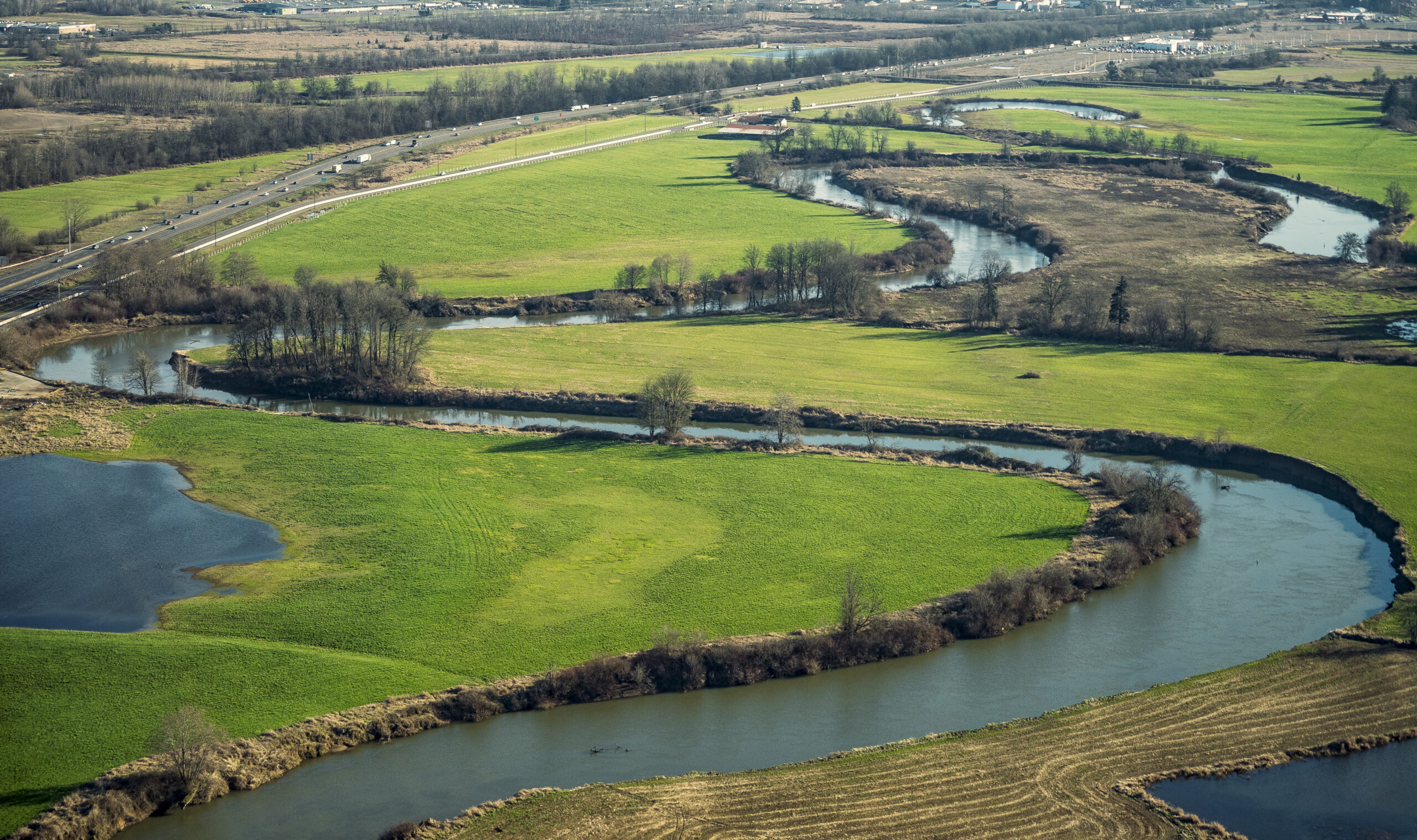
Past development in the Chehalis Basin has resulted in thousands of residential, commercial and industrial structures being constructed in the floodplain. Future expansions of the floodplain as a result of bigger storm events being driven by climate change threaten to encompass even more existing structures. Local planning and regulations have not always accounted for potential flooding to properties, but will need to guide growth away from floodplains in the future.
The Basin population is increasing, which will require community conversations about how and where growth occurs, neighborhood design, and costs. While the proposed Safe Structures Program addresses existing structures, other land use actions must address future development related to natural population and housing growth in a way that reduces the damage and cost of future flooding. These actions must:
- Support the voluntary relocation program for existing structures into receiving areas
- Prevent new development from occurring in harm’s way
- Ensure new development accounts for future flooding risks
- Increase coordination between local jurisdictions to reduce development in the floodplain
Receiving Areas
Along with implementing the Safe Structures Program, Basin communities need to identify potential receiving areas—areas within each community that are outside of the floodplain and that can accommodate both residents voluntarily moving out of the floodplain who want to remain in the community, and the needs of future growth. In an era of increased flooding, this is a critical adaptation in land use planning. The success of this program would be driven by a combination of public-sector influenced development policy and regulations, and private market-driven forces and dynamics.
The project team considered 6 elements in identifying potential receiving areas.
The Capacity for the Area to Develop
to relocate existing residents away from the floodplain along with natural future population and housing growth.
Land Located Outside
the 100-year late century 2080 floodplain, but within the existing urban growth boundary.
Areas that are Currently Zoned
for or have a future residential land use designation.
Vacant or Underutilized Land
that might have reduced barriers to development.
Land That’s Not Constrained
by critical barriers to development, such as wetlands, priority habitat areas or steep slopes.
Land With Potential
for future infrastructure development.
Growth in Receiving Areas
The project team identified nearly 4,500 acres of unconstrained land that would be available within the receiving areas. Areas will need to accommodate an estimated 130 houses to be built or relocated to accommodate participants in the Safe Structures Program. As projected natural population growth in the study area is about 15,600, the identified receiving areas have just about enough capacity to accommodate relocation and growth, in most communities(the high estimated growth of 15,090 plus relocated residents).
Housing and Population in Receiving Areas
The Town of Bucoda, City of Oakville, and the Grand Mound UGA seem to have sufficient developable land within their respective receiving areas to accommodate the expected population growth at current zoned densities. But the Cities of Centralia, Chehalis and Napavine might not have sufficient capacity, based on existing land use and zoning densities. So these communities would need to develop policies and regulations (such as zoning) allowing for higher residential building densities and the expanded infrastructure to support them.
Public Sector Actions
Local jurisdictions can undertake a number of actions to reduce the number of structures subject to potential flood damage within the floodplain and to encourage a long-term shift in private market real estate development patterns away from the floodplain. Actions have already been implemented in some, but not all, jurisdictions. The towns, cities and counties, Quinault Nation, and the confederated Tribes of the Chehalis Reservation have the economic and development foundation to create the necessary conditions of market shift through policies and programmatic, regulatory and infrastructure strategies and actions.
POLICY INTERVENTIONS. Cities and counties can revise comprehensive plan policies, including updated land use designations in both sending and receiving areas; revised floodplain development policies in comprehensive plan elements and countywide planning policies; potentially updated Urban Growth Areas; updated comprehensive flood hazard management plans; potential subarea and/or master planning in receiving areas; and revised equity and housing planning policies.
PROGRAMMATIC ACTIONS. Largely centered on the creation and operation of a Safe Structures Program, other programmatic avenues may be considered in parallel by local governments, including updating flood maps; joining the Community Rating System; a possible novel application of the state’s Transfer of Development Rights program; and utilization of the Open Space Taxation (aka the Current Use) program.
REGULATORY ACTIONS. Cities and counties will need to implement regulations for policy actions described above, such as zoning and development code revisions to implement new land use designations and additional flood protection; a model development code; updates to local and county Critical Areas Ordinances; implementing National Flood Insurance Program criteria; and Flood Damage Prevention Ordinance updates.
INFRASTRUCTURE PLANNING AND DEVELOPMENT. Public sector planning will continue to expand infrastructure into areas of each jurisdiction’s designated urban growth area that anticipate relocations under the Safe Structures Program and new development related to natural growth. Infrastructure actions may include capital improvement/facility plan and element updates; funding; and physical development.
New structure development and redevelopment in the receiving areas, including right-of-way and easement dedication and fee payment for infrastructure, will be undertaken predominantly by the private sector. Private sector actors, including individual landowners, developers, and brokers, will need to actively be encouraged to participate in programs and private property transactions for successful implementation.
Policy Recommendations
Policy Recommendations: Growth Management
Update comprehensive plans, as needed, to address land use, housing, infrastructure and critical areas:
- Update future land use maps to restrict development in the floodplain
- Expand Urban Growth Areas to incorporate receiving areas with planned city services
- Refine receiving area locations through subarea planning, including infrastructure requirements to support future development in receiving areas
- Assume Flood of Record boundary and expanded critical areas for land capacity analysis
- Assume voluntary relocation of identified structures to receiving areas
- Incorporate comprehensive flood hazard management planning to ensure consistency with all other management policies, such as the Safe Structures Program and receiving areas
- Address equity and affordable housing to include projections of the impact of updated plans and policies on housing needs and future land use designations
Local comprehensive plan updates are required in the next 3-5 years. They can establish the foundation for more resilient communities and less development in flood-prone areas.
Development Code
First, update flood maps within the Upper Basin to reduce development in flood prone-areas (if not already completed). Also review/update Development Codes:
- Complete audits of all development codes in the Basin related to floodplain development
- Create a model code and provide technical assistance to local jurisdictions to implement flood-related development and building code changes
- Update Critical Areas Ordinances for consistency between local and county ordinances and with other policy elements previously described
- Update Flood Damage Prevention Ordinances related to developer and shoreline permits, construction, flood protection and subdivision proposals
Some flood maps have not been updated in over 20 years.
Recommendations: Other Plan Updates
- Update Capital Facilities Plans in concert with Comprehensive Plan updates and other land use planning activities, including a short-term financing plan
- Prioritize required facilities and continue to update plans regularly to ensure facilities are in place to serve development in the receiving area
- Identify existing or new funding sources for capital projects—options include:
- Real estate excise taxes
- General obligation bonds
- Impact fees
- Local improvement districts
- Connection fees and Latecomer charges
- State and federal grants