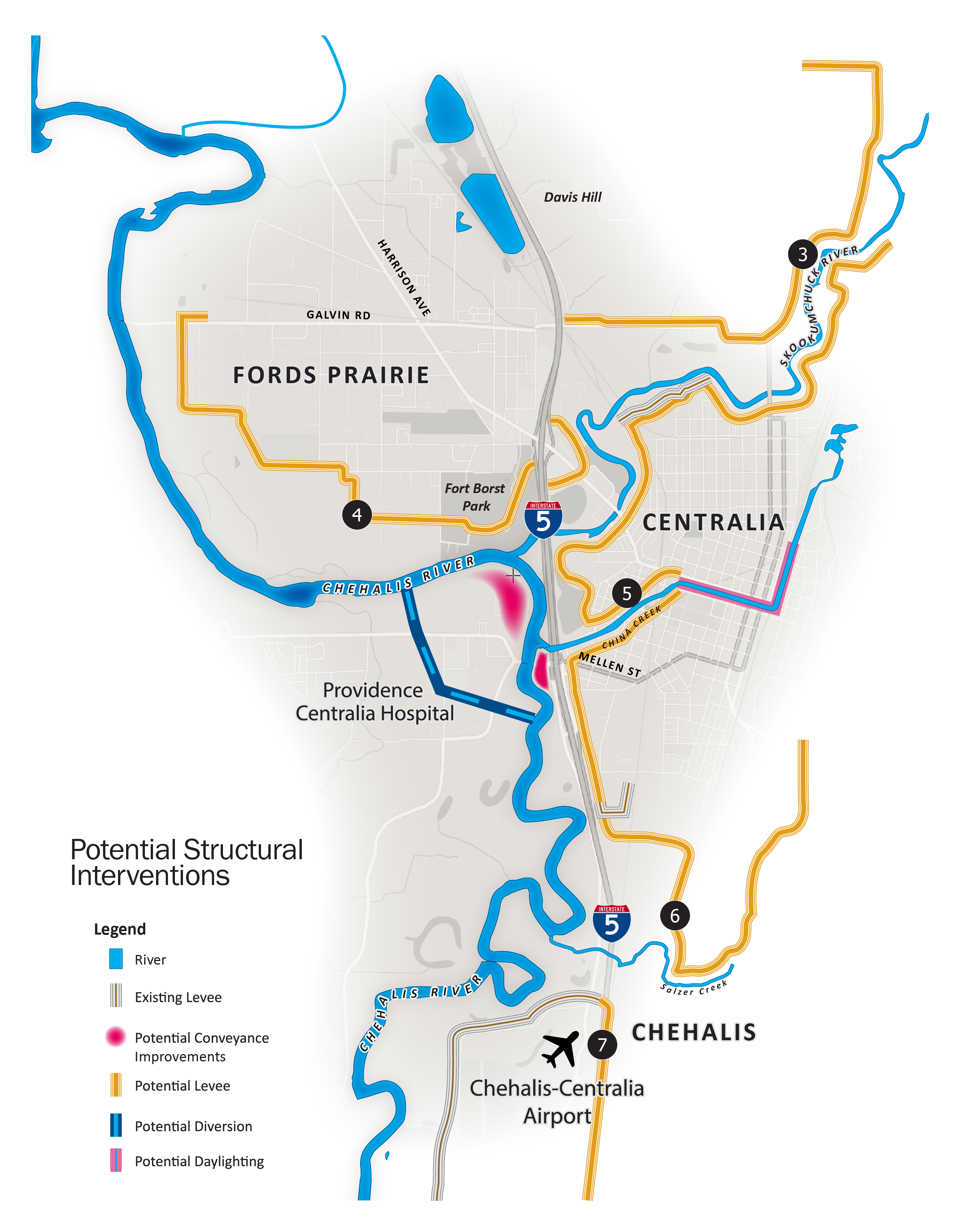
Potential Structural Interventions
Transportation System and Accessibility Improvements
While floodplain restoration and local flood management will reduce flood damage during smaller and more frequent flooding events, structural interventions such as levees and diversions, combined with the non-structural elements, will expand river capacity and reduce damage from a major flood.
West Diversion
This intervention will reduce peak flood elevations by providing another path for flood waters. It would:
- Construct a new 700-foot wide, one-mile long water diversion by excavating approximately 1.3 million cubic yards of soil west of existing Mellen Street.
- Remove the existing Mellen Street Bridge and reconstruct it about 2,000 feet to the south, to connect to Military Road west of the Chehalis River and I-5.
- Remove about 1.3 million cubic yards of soil immediately upstream from the existing Mellen Street Bridge and for approximately 3,000 feet downstream of the existing Bridge to increase the ability of floodwaters to flow through this constricted area.
Image showing existing diversion – looking north toward the Hospital
Image showing the proposed diversion with new Mellen Street Bridge, open space and recreation amenities
Image showing proposed diversion during a flood
Proposed Inlet to Diversion with Relocated Mellen Street Bridge
First Image: Existing – Looking North toward the Hospital
Second image: Proposed Diversion with New Mellen Street Bridge, Open Space and Recreation Amenities
Third image: Proposed Diversion During a Flood
New and Expanded Levees and Floodwalls
Constructing about 22.1 miles of new or expanded levees will help contain floodwaters and reduce flood damage. The majority of the levee and floodwall infrastructure is located next to high concentrations of existing structures that cannot be easily moved. Constructing new or expanded levees would affect some existing structures; the impacts will be dependent on the final size and location of levees, which is still to be definitely determined. Upstream and downstream impacts, such as where there is an increase in flood depth, would be mitigated through the Safe Structures program.
- Construct a new ring levee in Adna around the new high school and commercial area (1.7 miles)
- Construct new levee on the north bank of the Newaukum River east of I-5 (1.2 miles)
- Construct new and expanded levees on the north and south sides of the Skookumchuck River (6.6 miles)
- Construct a new levee on the north bank of the Chehalis River from north of Fort Borst Park downstream to Galvin Road (2.7 miles)
- Construct new levees on the north and south sides of China Creek from I-5 to the railroad tracks (2.3 miles)
- Construct a new levee on the east side of I-5 from China Creek south to Salzer Creek (3.3 miles)
- Expand the levee around the Chehalis- Centralia Airport (4.3 miles)
Levees could be constructed in phases and be combined with road and bridge projects.
Potential Adna Levee
Newaukum Levee
A map identifying the location of all potential structural interventions north of the Chehalis-Centralia Airport, including levees, conveyance improvements, diversions, and creek daylighting.
China Creek Daylighting
Image showing the existing China Creek
Image showing China Creek with adjacent new development
Image showing China Creek daylighting during a flood
First Image: China Creek – Existing
Second image: China Creek with Adjacent New Development
Third image: China Creek Daylighting – During a Flood
Structural Flood Damage Reduction
Most infrastructure—levees, the diversion channel, conveyance improvements—is located where there are high concentrations of homes, and commercial and institutional buildings (valuable structures) that cannot be moved.
The infrastructure and floodplain management efforts significantly reduce flooding extents with lower height levees. They increase water levels on the Skookumchuck and the Newaukum (less significantly), as well as on the Chehalis downstream of Mellen Street. This also lowers water surface elevation on the Chehalis upstream of Mellen Street and Salzer Creek.
These investments would remove about 1,625 valuable structures from the risk of flooding during a major flood that could occur in the late century, 2080. That leaves an estimated 1,634 structures that would still be vulnerable and require an additional program to reduce potential flood damage (see Safe Structures Program).
All Interventions
All Interventions
Inundation Levels -Baseline
Inundation Levels -Baseline
Inundated Structures with the Preliminary LAND Alternative
Inundated Structures with the Preliminary LAND Alternative
Transportation System and Accessibility Improvements
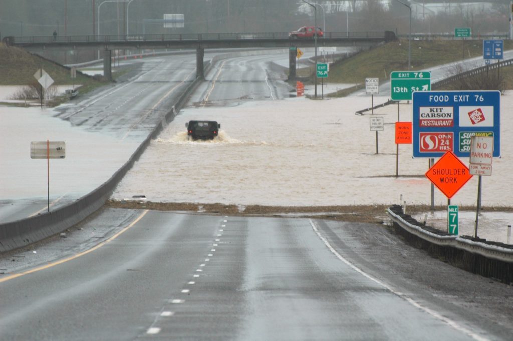
A major flood can inundate streets and roadways and some, including I-5, have been closed for several days due to flooding. Roadway closures have a dramatic effect on emergency services and transportation—and hinder community recovery efforts after an event.
While there are many potential transportation-related projects that could be implemented, the design and extent of these projects will be dependent on a number of factors, including:
IDENTIFICATION OF THE STORM SEVERITY
assumptions and LAND concept(d) assumed for construction.
PRIORITIZATION OF PROJECTS
based on emergency access needs, protection of essential facilities and equity impacts.
COORDINATION WITH LOCAL JURISDICTIONS
to identify any needed changes to address updated flood elevations.
IDENTIFICATION OF ANY AMENDMENTS
for projects already in existing plans or if not within existing plans, completing plan amendments to include it in a future capital improvement program.
The following projects would likely be a combination of city, county, and state leadership, depending on who is currently responsible for roads and/or bridges and how construction would be funded. (NOTE: Projects 14-17 shown on the map on page 38 still are still being defined and will be included in future analysis).
cost Ranges
$
$2M
$$
$2M–10M
$$$
$10M–24M
$$$$
$25M–49M
$$$$$
$50M
1. SOUTH SCHEUBER ROAD BRIDGE ($$$$$)
Install a new bridge from Fords Prairie across the Chehalis River to provide an alternative route for I-5 in the event of a closure. Concept layout of the new bridge is from South Scheuber Road to the south and Oakland Avenue to the north. Lewis County has studied this alignment in previous years.
2. SOUTH SCHEUBER ROAD–GRAF ROAD /MILITARY ROAD ($$)
Raise South Scheuber Road near the Graf Road/Military Road intersection to approximately 700 feet north of the intersection to maintain access to the hospital.
3. SOUTH SCHEUBER ROAD–WEST CONNECTION ($$$)
Raise sections of South Scheuber Road between State Route 6 and the Graf Road/ Military Road intersection. This project, in combination with projects 1 and 2 will complete an alternative route for I-5.
4. COOKS HILLS ROAD ($$$)
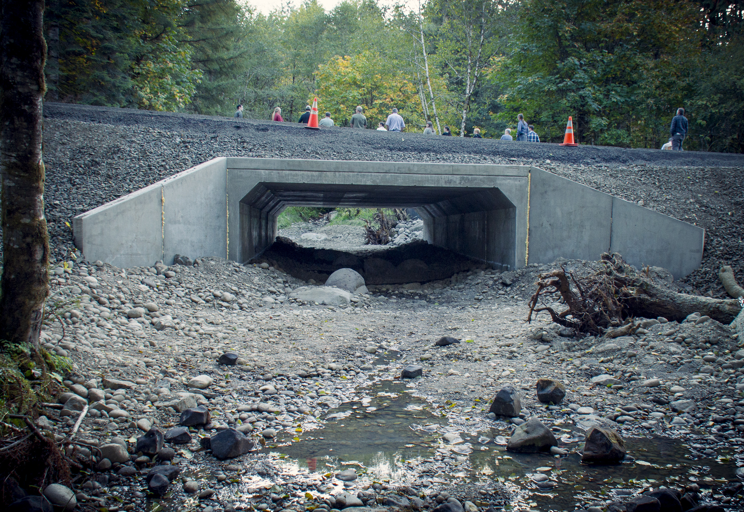
Raise Cooks Hill Road with structural fill to maintain access during an event. This project would also include raising utility castings and surface utilities (fire hydrants, communication and power cabinets and overhead utilities). This section of road does not have curb and gutter or sidewalks. Future improvements could include widening shoulders for a regional bike route and installing a fish friendly culvert or bridge at Scammon Creek.
5. STATE ROUTE 6 (SOUTH SCHEUBER ROAD TO I-5) ($$$$$)
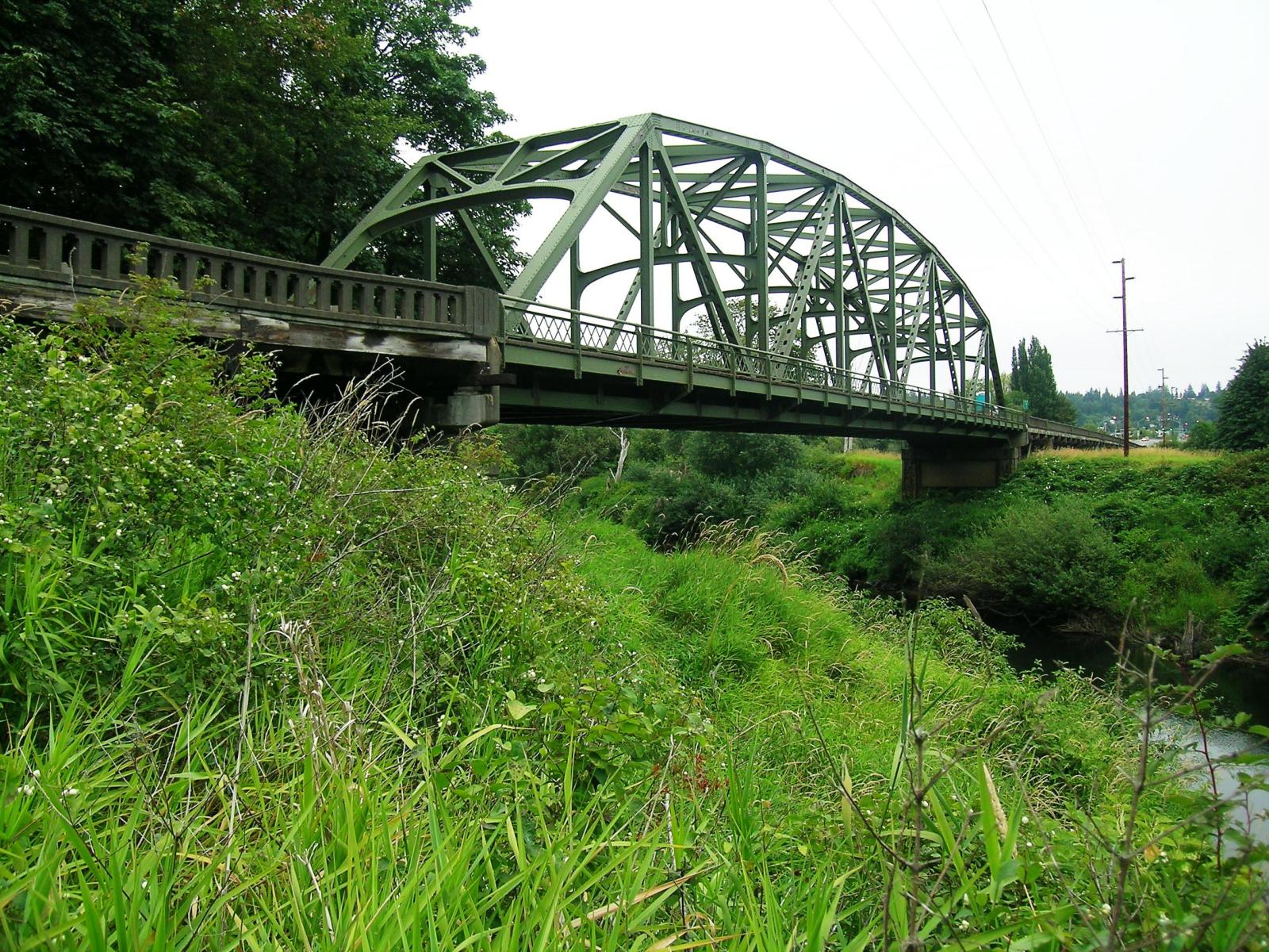
Replace the existing bridge constructed in 1939 and elevate sections of Highway 6 to improve floodplain connections and minimize upstream raised water surface elevation.
6. WEST MAIN STREET ($$)
Raise West Main Street or construct a levee system in coordination with BNSF to provide a transportation connection from Chehalis to I-5 during flood events. This would require BNSF to raise their tracks, or construct a levee with a break for the rail and install a pump station on the shoulder. In the event of a flood, floodgates would be installed across the tracks.
7. KRESKY AVENUE (COST TBD)
Raise National to NE Kresky Avenue between its intersections with N National Avenue , or provide a series of levees, to maintain the roadway for emergency vehicles during a flood event. While the road is currently one-way northbound, it could also accommodate two-way traffic between Chehalis and Centralia during flood events.
8. SR 507 THROUGH CENTRALIA ($$) (ASSUMES LEVEE COSTS ARE IN OTHER PROJECTS)
SR 507 provides a connection from the existing Mellen Street Bridge area to the north of Centralia but is inundated in larger storm events. This project would provide levee protection for the roadway, but would also be coupled with other projects, such as projects 9 and 12.
9. PEARL STREET (SR 507) AND PEARL STREET BRIDGE ($$)
This section of roadway is in an area that frequently floods. This project would include replacing the existing 1928 bridge and raising the roadway to would allow for vehicle passage. The height of bridge raising would be determined in concert with Skookumchuck Levee configuration and modelling results.
10. REYNOLDS ROAD ($$$)
Reynolds Road provides an important east/west connection across I-5, but regularly floods near the Skookumchuck River. Raising the roadway with structural fi ll and increasing the width of the road prism would keep the road open and passable. Utility castings would be raised to the new asphalt road surface fi nish elevation and surface utilities (fire hydrants, communication and power cabinets and overhead utilities) would also be raised to the new roadway elevation. This section of road does not have formal curb gutter sidewalk. There is a current project to widen the roadway and add a center turn lane. The Lewis County project team could review the option to raise the roadway as part of their analysis. A levee would be needed near the Reynolds and BNSF undercrossing of I-5. A Skookumchuck levee north of Downing Road would be needed to keep Skookumchuck flows from entering Coffee Creek unless Skookumchuck flows are mitigated up stream. An alternative to raising the roadway would be to install a levee south of the roadway.
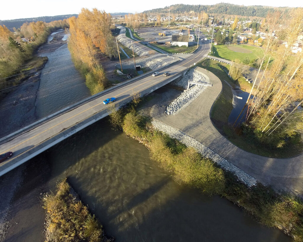
11. NEW MELLEN STREET BRIDGE–SOUTH ($$$$)
This project would be required if additional conveyance projects are constructed in the general vicinity of the existing Mellen Street Bridge. The project would construct a new bridge across the Chehalis valley from the Ellsbury Overpass to Military/Scheuber Road to provide an operational vehicular connection during the storm events. This project is included in Options 2 and 4 because those options would require removal and relocation of the existing Mellen Street Bridge and approaches.
12. RAISE S-12, CHEHALIS RESERVATION TO ROCHESTER (cost tbd)
This project would raise or protect SR-12 between the Chehalis Reservation and the city of Rochester to the west to preserve emergency access routes for the area.
13. RAISE ANDERSON ROAD (NEED COST)
Anderson Road is the primary access road to the Chehalis Reservation and is inundated during flood events, limiting access to key facilities off of the Reservation. This project would raise the roadway to maintain access during a flood event.
A black-and-white aerial photograph of the Chehalis Basin southwest of Chehalis, illustrating Option 1: Safe Structures and Floodplain Management. The image includes a graphical overlay indicating the 2080 Late Century Flood Boundary.
Specific callouts on the map describe the following key elements: 1. Maximize floodplain restoration, where feasible, that also allows existing agriculture to operate; 2. Increase access to the river using floodable parks, trails, and other open space; 3. Improve riparian areas along rivers and streams.